In the first of two articles, Dr Colin Runeckles discusses his findings following research into a Wanstead and Woodford Borough Council building survey carried out in 1949
While I was putting together my January talk on ‘Building Wanstead’, Sue Page at the Heritage Centre in Redbridge Central Library handed me an archive box and wondered whether I would be interested. Inside was a survey carried out after WWII about the condition of every building in the Wanstead and Woodford Borough Council area. The area that I have so far input into a spreadsheet – nearly 5,500 entries – covers Wanstead and Snaresbrook.
The date of the survey appears to be late 1949. There are no building dates after 1949, and on the second from last page, there is a note to the effect that a Ministry of Labour camp on Wanstead Flats is “Now redundant at 27.10.49.” I haven’t managed to ascertain whether this survey was a local initiative or part of a national review. Although all buildings have an original or rebuilding date for those suffering excessive bomb damage, some of the older dates are dubious given other evidence, such as building plans or where they appear on old maps.
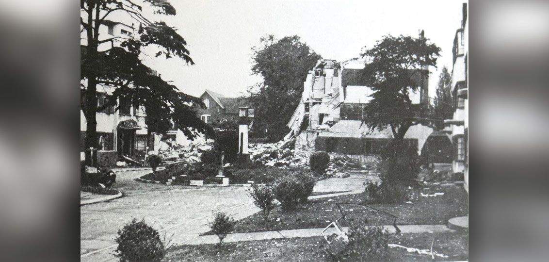
What does it tell us about the damage to buildings in WWII? There are 50 vacant plots listed due to buildings being destroyed by enemy action and relating to 43 houses, five shops and houses (49–57 High Street Wanstead), Park House on the corner of Blake Hall Road and Overton Drive that had been converted into flats shortly before the war, one block of The Shrubbery on Grosvenor Road, and the Isolation Hospital close to Wanstead Park. A further 103 buildings had already been fully repaired. Again, this mainly relates to houses, although it also includes one of the parts of Woodford House on the corner of Eagle Lane. Over 2,800 are shown as having “Substantial war damage repairs”, and when I eventually get to building plans of the post-war period, it will be interesting to make a comparison of the two sets of data. All of those fully rebuilt or showing vacant plots could be plotted on a map to show a more detailed picture of the significant areas of damage caused by enemy action in Wanstead. For example, 54 Hermon Hill is extremely close to houses destroyed in Sylvan Road (36–38 and 23–25) and almost certainly due to the same incident.
But there was some building carried out in this period – two canteens (presumably for workers in the underground tunnels) for Plessey’s were built around 1940 – one in the car park of The George, the other in Highstone Avenue. A building on the High Street shown on post-war maps just north of Clockhouse Parade is revealed in the survey to be a British Restaurant (communal kitchens set up by the Ministry of Food).
Next month’s article will look at what the survey can tell us about post-war building developments.